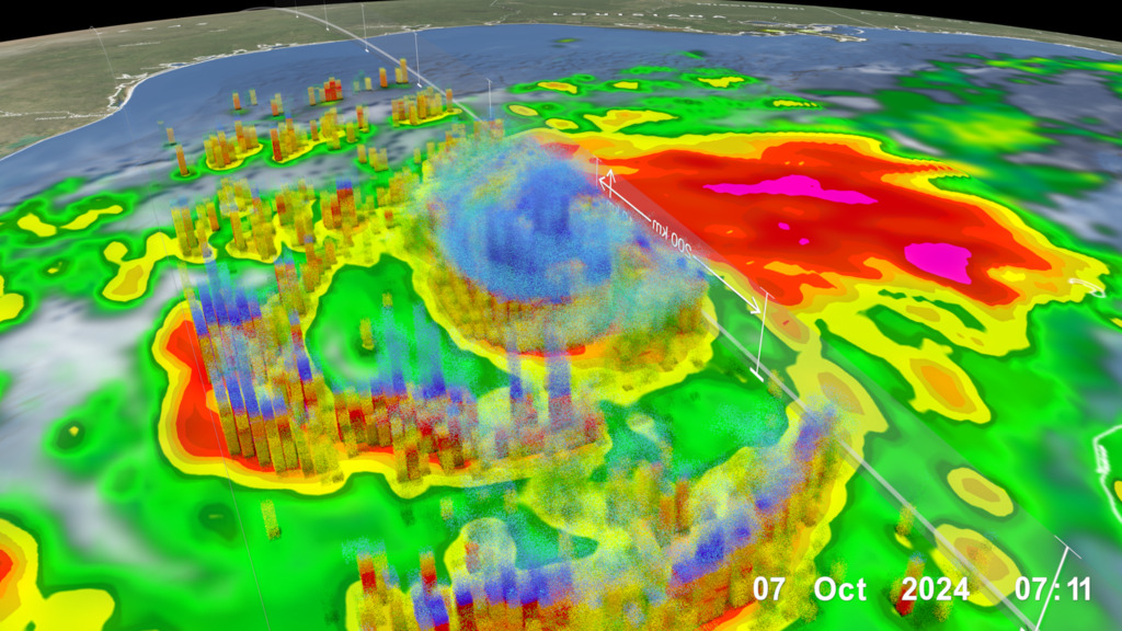
Today is June 1, the official start of the Atlantic hurricane season, and it is tempting to file that under “somebody else’s problem.” Dallas sits about 250 miles from the nearest saltwater. No storm surge is coming up Interstate 45. But ask anyone who was here in September 2010, when what was left of Tropical Storm Hermine parked over the Metroplex, and you will hear a different story.
The truth is that hurricane season matters in North Texas for one big reason: rain. When Gulf storms come ashore and fall apart, their leftover moisture often rides north and wrings itself out over our part of the state. That has meant flash floods, drowned low-water crossings, and even tornadoes right here in Dallas and Tarrant counties. Here is what the season ahead looks like, what history says about our exposure, and the short list of things worth doing now.
What NOAA expects this year
In late May, federal forecasters released their outlook for the season, which runs June 1 through November 30. NOAA is predicting a below-normal season: 8 to 14 named storms, with 3 to 6 becoming hurricanes and 1 to 3 reaching major-hurricane strength. The agency puts the chance of a below-average season at 55 percent, largely because an El Nino pattern is expected to develop and strengthen through the summer, which tends to suppress Atlantic storms.
Two cautions come with that. First, the outlook is a count of storms, not a landfall forecast; it says nothing about whether any particular storm hits Texas. Second, as National Weather Service director Ken Graham put it in the outlook announcement, “It only takes one storm to make for a very bad season.” The quiet-season label did not help anyone in 1983, a below-average year that still produced Hurricane Alicia and a soaking in North Texas.
How Gulf storms reach DFW: the receipts
The National Weather Service office in Fort Worth keeps a running history of tropical systems that have affected North Texas, and it goes back to the 1870s. A few entries stand out for anyone who thinks we are out of range:
Hermine, September 2010. The remnants of Tropical Storm Hermine moved through the western half of North Texas and dropped up to 12 inches of rain, with the heaviest totals along the I-35 corridor. Crews performed numerous high-water rescues, eight tornadoes touched down, including an EF2 that moved through the western city limits of Dallas, and two people died in the flooding.
Tropical Depression Bill, June 2015. Bill came ashore at Matagorda Island and tracked north near I-35, putting more than a foot of rain on parts of Montague County and flooding Wise, Montague and northern Parker counties on ground already soaked from a wet spring.
The remnants of Pacific Hurricane Norma, October 1981. Yes, Pacific storms count too. Norma’s leftovers dumped 10 to 13 inches between Denton and Bridgeport, and five people drowned in Tarrant County.
The pattern in that list is worth noticing: the danger here is almost never wind off the Gulf. It is water, and it tends to arrive in June or in September and October, on either side of the deep-summer heat.
Flash flooding is the local threat, so drive like it
Most flood deaths in this region happen in vehicles, at low-water crossings, often at night. The rule the Weather Service drills for a reason is Turn Around, Don’t Drown: as little as 12 inches of moving water can carry off most cars, and you cannot judge depth over a washed-out road in the dark. When tropical moisture is in the forecast, give the usual creek-side shortcuts a week off.
At home, the checklist is modest. Clear your gutters and the storm drain at your curb. Know whether your street or a road you drive daily has a history of ponding. And remember that homeowners insurance does not cover rising water; flood coverage is a separate policy with a waiting period before it takes effect, so the time to ask your agent about it is before a storm has a name.
Make sure warnings can actually reach you
Tropical rain events tend to peak overnight, which is exactly when outdoor sirens and daytime habits fail you. Check that Wireless Emergency Alerts are enabled on your phone, and consider a NOAA weather radio for the bedroom. The NWS Fort Worth office covers all of North and Central Texas and posts watches, warnings and rainfall forecasts around the clock; its forecast discussion will flag tropical moisture days in advance of the first drop.
If a remnant system does spin up tornadoes, as Hermine did, the same watch-and-warning rules apply as in spring: a warning means take shelter in an interior room on the lowest floor, right then.
The bottom line for North Texas
Nobody in Dallas or Fort Worth needs plywood for the windows this week. What we need is the habit of taking Gulf leftovers seriously. A below-normal season forecast is good news for the coast, but the outlook explicitly does not tell you whether one wet system will wander up I-35 in September, and one is all it takes. Keep the phone alerts on, keep the car out of flooded crossings, and treat “remnants of” in a forecast as a headline, not a footnote.
This article was produced with AI assistance and reviewed by a human editor. Figures are linked to their primary sources; where a claim could not be verified from the public record, we say so.

Leave a Reply